
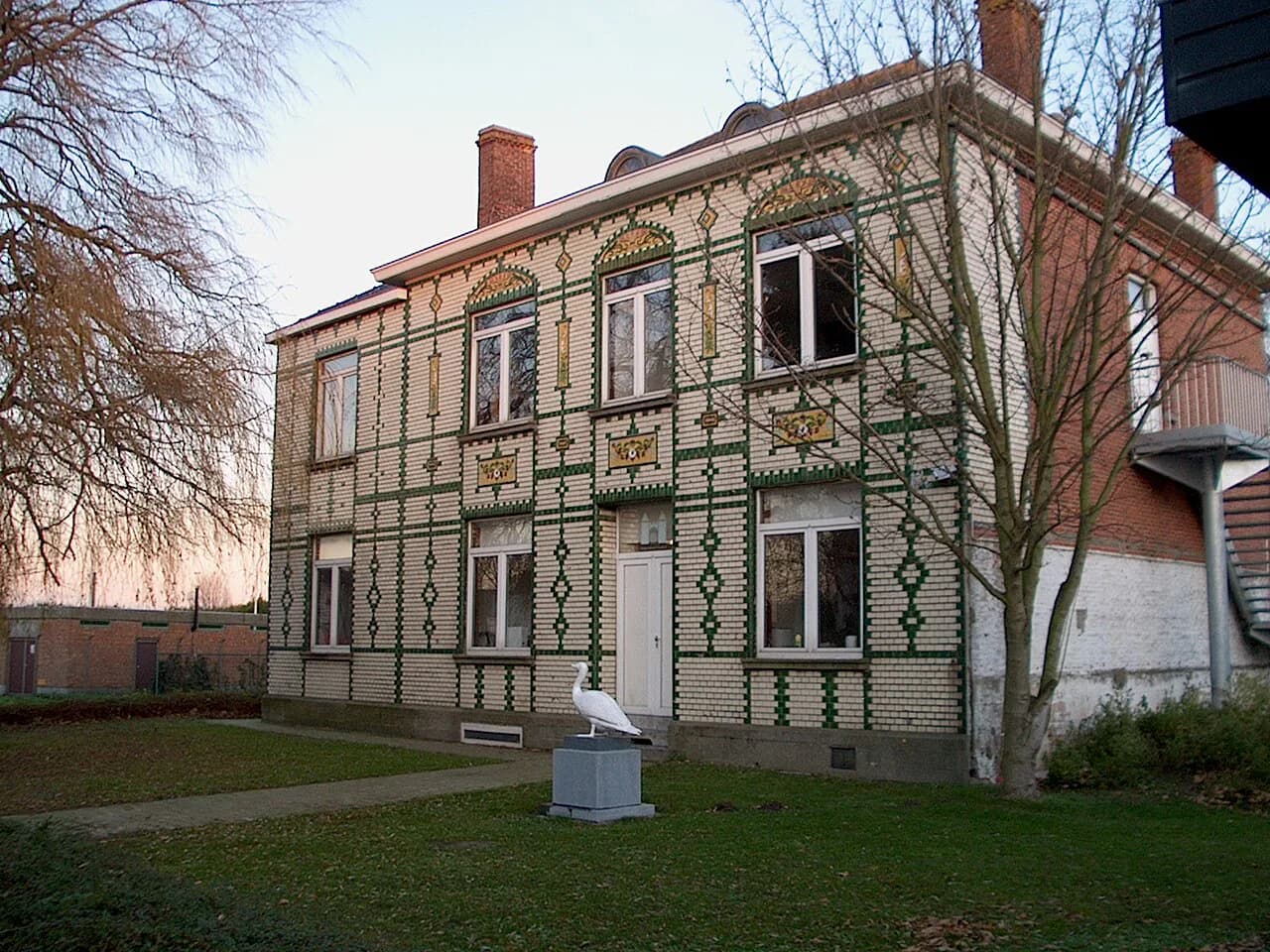
Zandvoorde, Ostend: Ostend's Polder Village

Zandvoorde is not a seaside extension of Ostend but a polder village that was a municipality in its own right until it merged with the city in 1971. It suits travellers who want flat farmland, working clay heritage and a village core on a sandy ridge, and it will disappoint anyone hoping for promenade, beach or a cluster of city attractions. This page sets out the district's two halves, its scattered landmarks and how far apart they sit.
Administratively Zandvoorde is a deelgemeente of Ostend (Oostende) in West Flanders, and its territory covers roughly 945 hectares on clay ground two to four metres above sea level. It belongs to the Historic Polders of Ostend, a landscape of straightened roads, ditches and pasture rather than dunes. Treat it as a half-day of walking and looking, not as a district to base a whole city break around.
What Zandvoorde is and where it sits
The historic village is a ribbon of buildings strung along a sandy creek ridge, principally Zandvoordedorpstraat and the Grintweg. The name is explained as a fordable crossing, tied to sand deposited in an eroded creek as sea levels rose between roughly the fourth and eighth centuries. Walking the village street therefore takes you along a single long line rather than around a square.
The Brussels-Ostend road, finished in 1958, broadly divides the district into two very different halves. South of it lie the old village, its twentieth-century extensions and open polder; north of it, adjoining the port area, sits industry. Decide which half you are heading for before you set out, because the two are not joined by a compact circuit.
Population figures for the district are dated: the heritage inventory records about 2,886 inhabitants on 1999 data, so do not read them as current. Zandvoorde's interest for a visitor lies in its landscape and buildings, not in any bustle. The city's own neighbourhood information is the sensible place to confirm present-day services.

Canal, railway and road through the polder
Three transport lines cut across Zandvoorde, and each has a date worth knowing. The Plassendale-Ostend canal was first traced in 1622, partly reused as a drainage channel in the later eighteenth century, and re-cut on a new northern line in 1664-1666; the Plassendale lock complex lies on it. The Bruges-Ostend railway arrived in 1838 and has a halt on the Stationsstraat.
The Plassendale-Ostend canal and the Plassendale-Nieuwpoort canal water the polder and shaped its fields. The Gistelsesteenweg, laid out around 1883 from Ostend through Stene and Zandvoorde to Gistel, was built to move fertiliser into the polders and crops out of them. Stene, Ostend lies between the city and this village on that same road, which makes it the natural neighbouring district to pair with a visit.
The fourth line no longer carries trains: the Ypres-Ostend railway opened in 1868 and has been out of service since 1959. Its trackbed survives as a walking path through the territory, giving an easy, level line to follow without any route-finding. Combine it with the village street for a straightforward polder walk.

The old village core on the sand ridge
The village core is modest: a long curving street on the sand ridge, a church site dedicated to Our Lady and raised to a parish in 1249, and later infill from the 1950s onwards. Two windmills and an oil mill once served the farming community, remembered in the street name Graanmolenstraat. Look for the older houses among the newer ones rather than expecting a preserved set piece.
Of the castle of Zandvoorde, the so-called Duvelstorre, only history remains: it was already a ruin by around 1650 and was not rebuilt. In the village itself, the farm known as de Zande on the Zandvoordestraat has a core going back to the seventeenth century. It is a farm building, not a visitor attraction, so admire the fabric from the street.
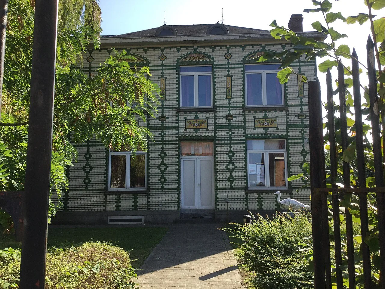
A scatter of detached farm labourers' houses survives along the ribbon, and a village school opened in 1846, with a school founded by the Sisters of St Vincent de Paul in 1897. These are small traces rather than sights. Give the core a gentle hour and save your energy for the polder beyond it.
Polder landscape and protected Grote Keignaert
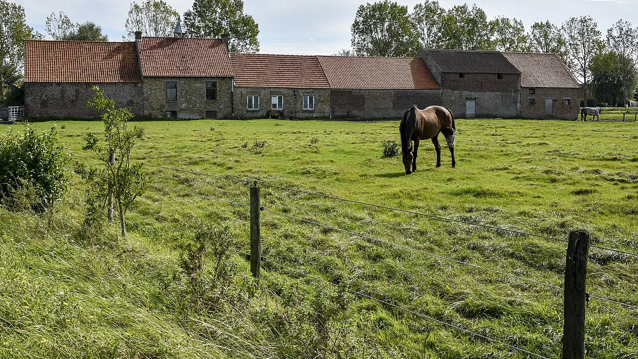
The Grote Keignaert in the newer Zandvoorde polder is a remnant of a closed-off creek that once branched from the Gauwelozekreek, and it has been protected as a landscape since a ministerial decree of 27 November 1992. The surrounding polder is now largely given over to cattle. This is the district's strongest reason to come, and it rewards slow looking rather than a checklist.
Three notable farms survive in the pasture. Groot Meeuwenhof on the Polderdijk and Welgelegen on the Grintweg both go back to the first quarter of the nineteenth century, the former keeping its broad free-standing barn; de Zande is older still. All are working or private farmsteads, visible from the lanes. Walk the polder roads and ditches rather than expecting a visitor centre.
The polder's straight, intersecting roads were laid out after the land was reclaimed around 1700, with the Keignaertpolder beyond diked off and reclaimed from 1803. Their rational grid is part of the scenery. Get out on foot or by bike along the Grintweg and the Polderdijk and the landscape explains itself.
Working clay: the Keignaert brickworks and clay pits
The brickworks de Keignaert on the Grintweg was still working when the heritage inventory was compiled, and it is the district's clearest link to its industrial past. Clay pits east of the Stationsstraat are the remains of former brick and tile works. Do not assume the site is open to the public: view it from the road and treat it as landscape, not a museum.
North of the Brussels-Ostend road, industry adjoins the port, including a creosote yard out of operation since 1984 and the site of the former Union Chimique Belge, now CNO. This is passing landscape rather than a destination. If you want the port's working side, the harbour itself is the better place to look.
Who Zandvoorde suits, and how long it takes
Zandvoorde suits walkers who like flat polder, farm buildings, waterways and industrial archaeology, and who are content to move between them on quiet roads. It does not suit anyone wanting a compact old town, a museum cluster or a seaside promenade within a few minutes of their hotel. If your Ostend trip is one or two days, this is a detour, not the main event.
Allow half a day on foot for the village street, the polder lanes and the old railway path, more if you linger at the Grote Keignaert. The distances are level and straightforward, but the landmarks are spread across the district rather than gathered in one spot. Bring waterproof footwear for wet polder paths and check the weather before setting off.
If you want a coastal district with more variety to fill a day, Mariakerke and Raversijde are the closer alternatives. Mariakerke Ostend gives you a seaside stretch with the city within reach. Raversijde, Ostend adds open coastal land and a wartime heritage site.
Getting there and getting around
The Bruges-Ostend line has a halt on the Stationsstraat, which puts the district within a short hop of the city centre and the coast. The Gistelsesteenweg from Ostend through Stene is the other obvious approach, arriving by road into the village. Either way, the railway path and the polder lanes are easiest on foot or by bike.
Getting around Zandvoorde means using the lanes, the polder roads and the old railway path rather than a single main drag, so plan a loop rather than an out-and-back. The canal towpath and the Plassendale lock complex are natural turning points. Bring a map showing Zandvoordedorpstraat, the Grintweg and the Polderdijk before you leave the city.
Does Zandvoorde earn its place in your Ostend trip?
Zandvoorde earns a half-day if you want polder landscape, the protected Grote Keignaert and working clay heritage at the edge of Ostend. If you are here for the short city break, the old town and the coast will compete for your hours. Pair the district with Stene, Ostend on the same Gistelsesteenweg road and treat Mariakerke Ostend or Raversijde, Ostend as the alternatives if you want the water.
Explore more Ostend guides
Frequently Asked Questions
Is Zandvoorde a deelgemeente of Ostend?
Yes. Zandvoorde was a municipality in its own right until it merged with Ostend in 1971. The heritage inventory describes its agricultural and industrial character and its membership of the Historic Polders of Ostend.
How many people live in Zandvoorde?
The heritage inventory gives about 2,886 inhabitants on 1999 data and an area of roughly 945 hectares. That figure is a historical snapshot, so for today's picture use the city's neighbourhood information.
What is there to see in Zandvoorde?
The strip of village buildings on the sandy ridge along Zandvoordedorpstraat and the Grintweg, the polder lanes, the protected Grote Keignaert creek and three surviving farms. The disused Ypres-Ostend railway line is now a walking path.
How long does a visit to Zandvoorde take?
Plan half a day on foot for the village street, the polder lanes and the old railway path, and add time to linger at the Grote Keignaert. The district is spread out, so walking is the main way to cover it.